

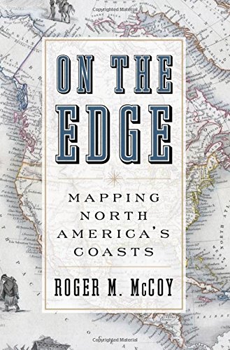
On the edge Mapping North America’s Coasts 1st Edition by Roger Mccoy 0199744041 9780199744046


Original price was: $50.00.$35.00Current price is: $35.00.
On the edge Mapping North America’s Coasts 1st Edition by Roger Mccoy – Ebook PDF Instant Download/Delivery: 0199744041, 9780199744046
Full download On the edge Mapping North America’s Coasts 1st Edition after payment
Product details:
ISBN 10: 0199744041
ISBN 13: 9780199744046
Author: Roger M. Mccoy
With our access to Google Maps, Global Positioning Systems, and Atlases that cover all regions and terrains and tell us precisely how to get from one place to another, we tend to forget there was ever a time when the world was unknown and uncharted–a mystery waiting to be solved. In On the Edge, Roger McCoy tells the captivating–and often harrowing–story of the 400 year effort to map North America’s Coasts. Much of the book is based on the narratives of mariners who sought a passage through the continent to Asia and produced maps as a byproduct of their journeys. These courageous explorers had to rely on the most rudimentary mapping tools and to contend with unimaginably harsh conditions: ship-crushing ice floes; the threat of frostbite, scurvy, and starvation; gold fever and mutiny; ice that could lock them in for months on end; and, inevitably, the failure to find the elusive Northwest passage. Telling the story from the explorers’ perspective, McCoy allows readers to see how maps of their voyages were made and why they were so full of errors, as well as how they gradually acquired greater accuracy, especially after the longitude problem was solved. On the Edge tracks the dramatic voyages of John Cabot, John Davis, Captain Cook, Henry Hudson, Martin Frobisher, John Franklin (who nearly starved to death and become known in England as “the man who ate his boots”), and others, concluding with Robert Peary, Otto Sverdrup, and Vihjalmur Steffanson in the early twentieth century.Drawing upon diaries, journals, and other primary sources–and including a set of maps charting the progress of exploration over time–On the Edge shows exactly how we came to know the shape of our continent.
On the edge Mapping North America’s Coasts 1st Table of contents:
Part I | The Earliest Ventures To North America To Find A Northwest Passage, 1492–1543
1. The Urge to Discover New Lands and Make Maps
2. John Cabot Makes a Claim for England, 1497
3. Giovanni da Verrazzano Maps an Ocean of His Imagination, 1524
4. Jacques Cartier Gives France a Prize, 1534, 1535, 1541
Part II | England Reenters The Game, 1576–1632
5. Ships, Navigation, and Mapping in the Sixteenth Century
6. Martin Frobisher Succumbs to Gold Fever, 1576, 1577, 1578
7. John Davis Makes a Near Miss, 1585, 1586, 1587
8. Henry Hudson Has a Very Bad Day, 1607, 1608, 1609, 1610
Part III | West From The Pacific; Overland To The Arctic Ocean, 1728–1789
9. Bering and Chirikov by Sea, 1741; Hearne, 1770 and Mackenzie, 1789 by Land
10. James Cook Maps a Huge Swath of the Northwest Coast, 1778
Part IV | The British Surge To Find The Northwest Passage Also Makes Maps, 1818–1845
11. John Ross Sees a Mirage, 1818; John Franklin Makes His First Expedition, 1819
12. William E. Parry Has Beginner’s Luck, 1819, 1821, 1824
13. John Franklin’s Second Overland Expedition Makes a Successful Survey, 1825
14. John Ross’s Second Voyage Lasts Four Hard Years, 1829–1833
15. Peter Dease and Thomas Simpson Extend the North Coast Map, 1837
16. John Franklin’s Last Expedition Becomes the Failure of the Century, 1845
Part V | The Franklin Searchers Almost Finish The Map, 1847–1858
17. The First Searchers Look in the Wrong Places, 1847
18. John Rae Hears about Franklin from Eskimos, 1848
19. Robert McClure Completes the Passage; Richard Collinson Maps Coastlines, 1850
20. Elisha K. Kane Barely Survives, but Maps New Land, 1853
21. Francis L. M’Clintock Extends the Map and Learns What Happened, 1857
Part VI | Shifting The Focus To The North Pole Fills In Vacant Spots On The Map, 1875–1920
22. George Nares Maps the North Coast of Ellesmere Island and Relearns Lessons, 1875
23. Otto Sverdrup Maps an Immense Area, 1898
24. Vilhjalmur Stefansson Maps New Islands, 1913
25. A Few Final Thoughts
Glossary
Appendix A: A Chronology Of Selected Expeditions To North America
People also search for On the edge Mapping North America’s Coasts 1st:
on the edge mapping north america’s coasts
northwest coast on a map
a map of the east coast of america
a map of the east coast of the united states
Tags:
Roger Mccoy,Mapping,Coasts,edge